
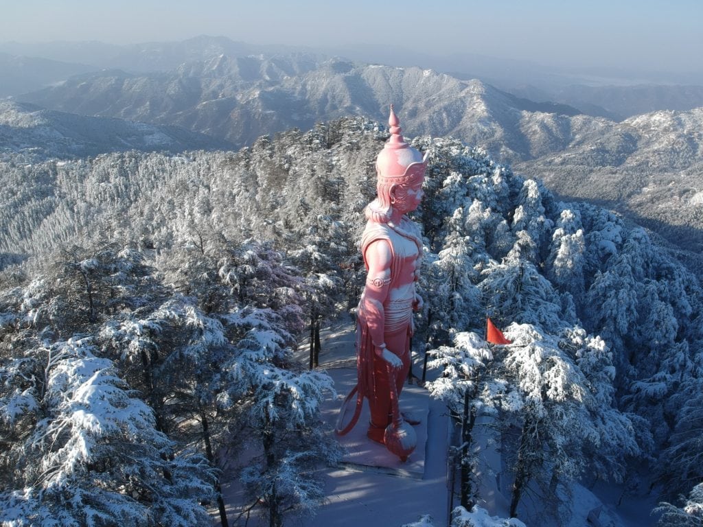
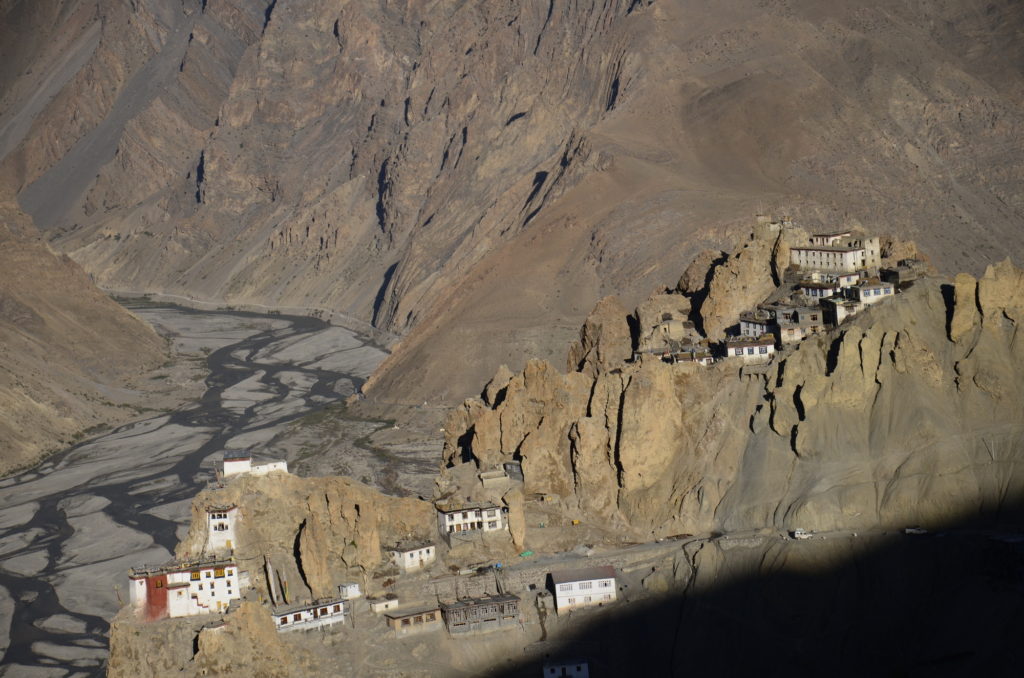
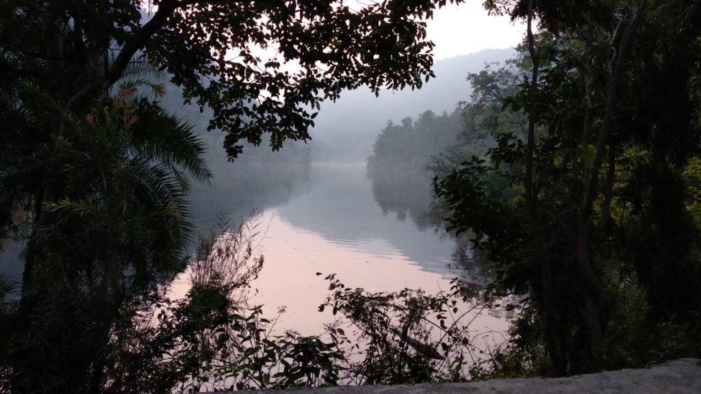
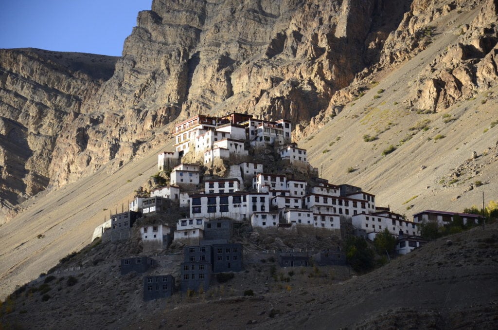
- All (76)
- Footsteps of Rama (3)
- Himachal (16)
- Quiz (0)
- Temples (16)
Case 1
Resilience
")
Focus
Will Power
Olympics
Elementor #6683
Manifestations of Shiva
Republican Traditions

The Variety of Sankranti

Surya, A Solstice Quiz

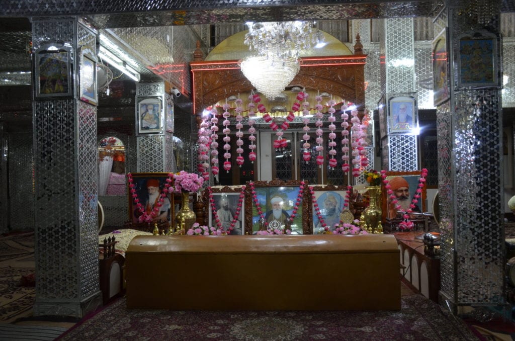
Gurudwaras – Legends and Locations

Gurudwaras – Legends and Locations
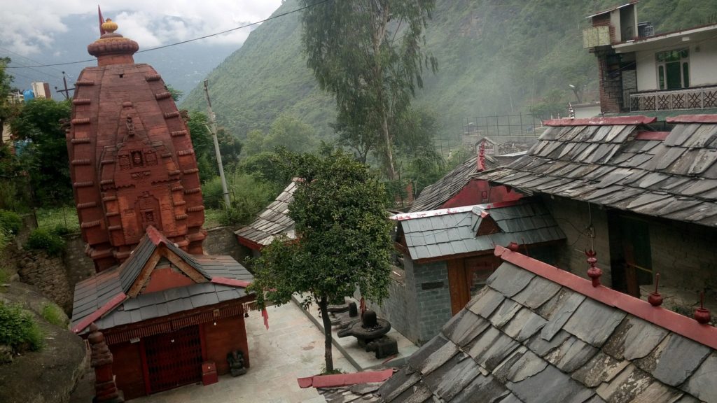

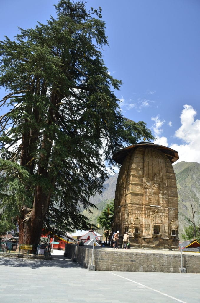
Perfect setting for the soul. Baijnath
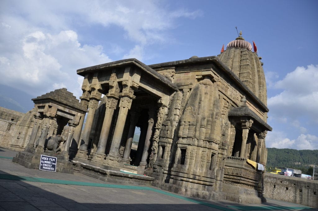
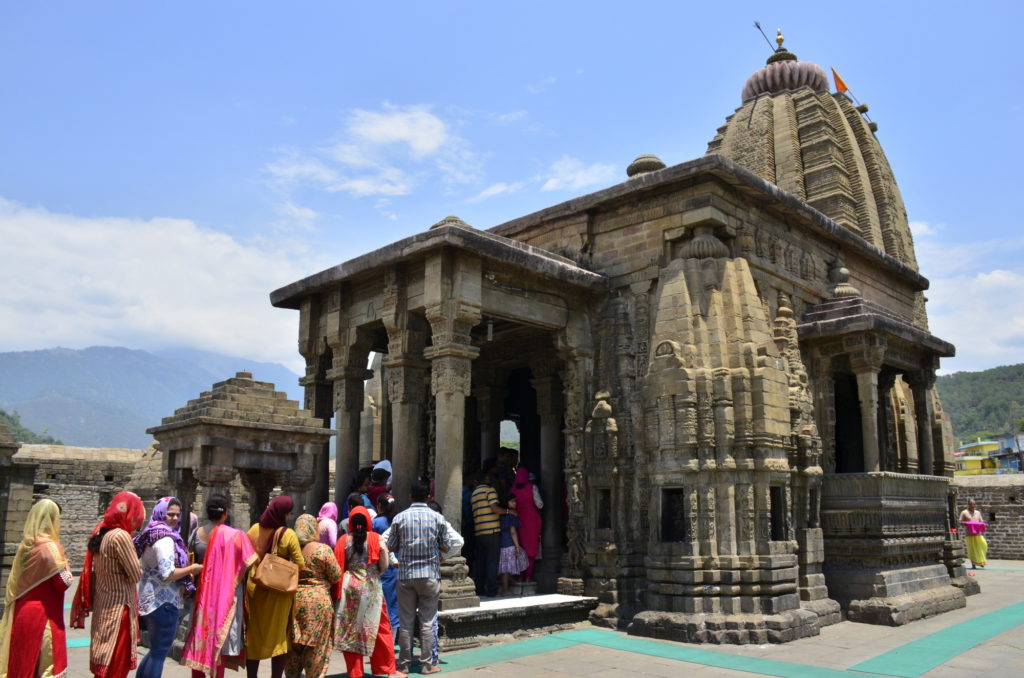
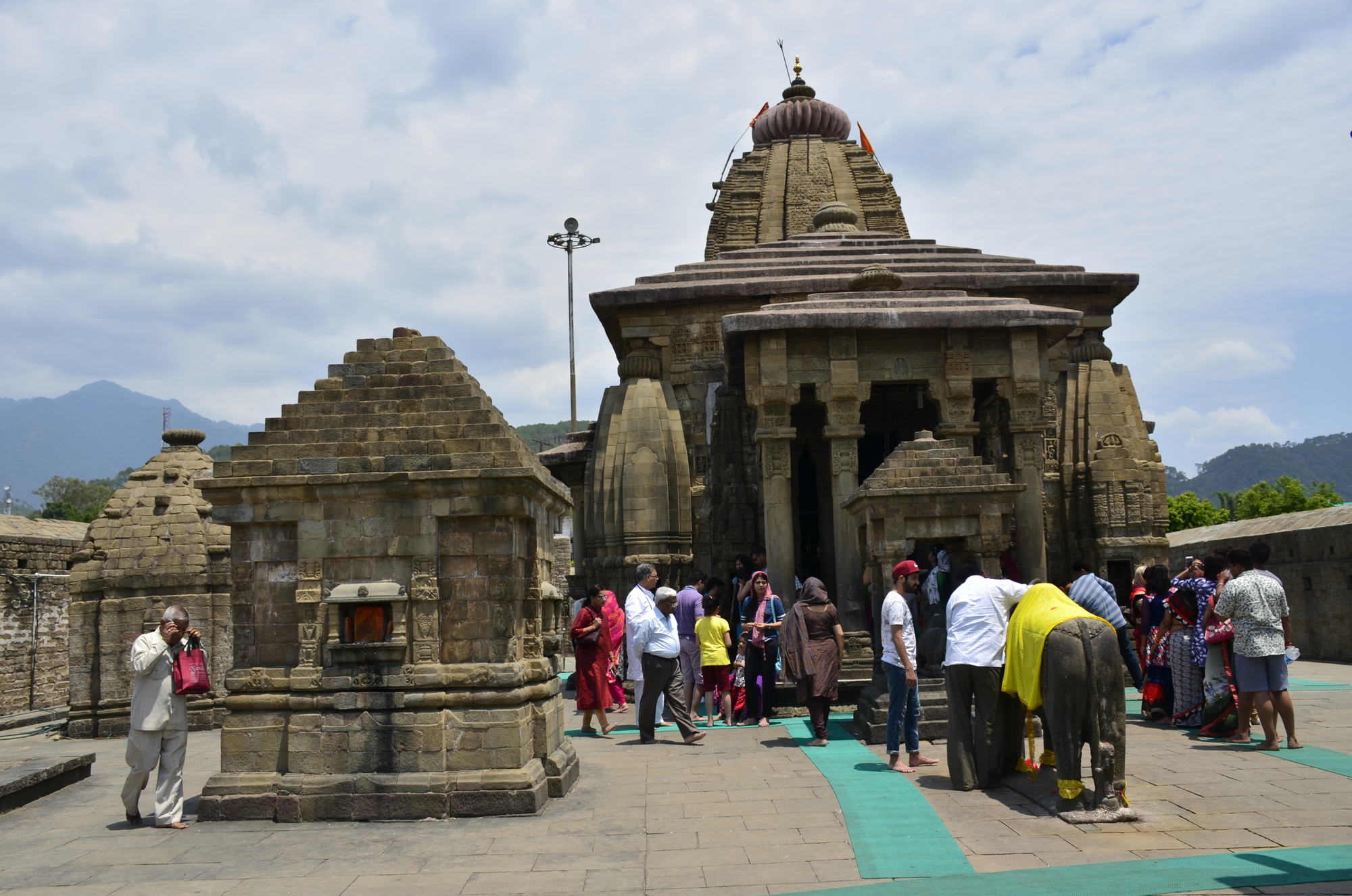
Baijnath, Temples of Himachal…16
Timeless, grand, picturesque, popular, clean and peaceful. Very few temples have the perfect mix that Baijnath has. It is the setting for the soul.
Timeless worship
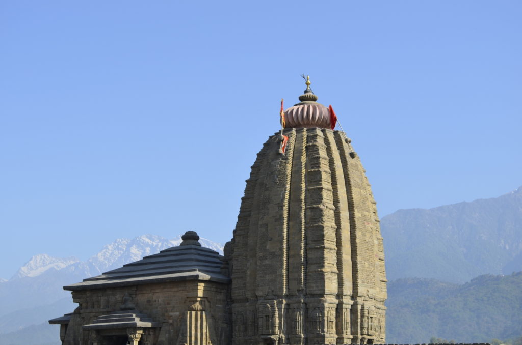
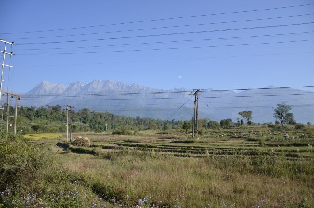
It is perched 50 meters high from the undulating Palampur fields. The river Binduka cuts a shallow valley along the edge of the hills. The temple has a recorded and verified history of 800 years; and possibly a timeless one before that. Shiva is worshipped as the Lord of Physicians in Baijnath.
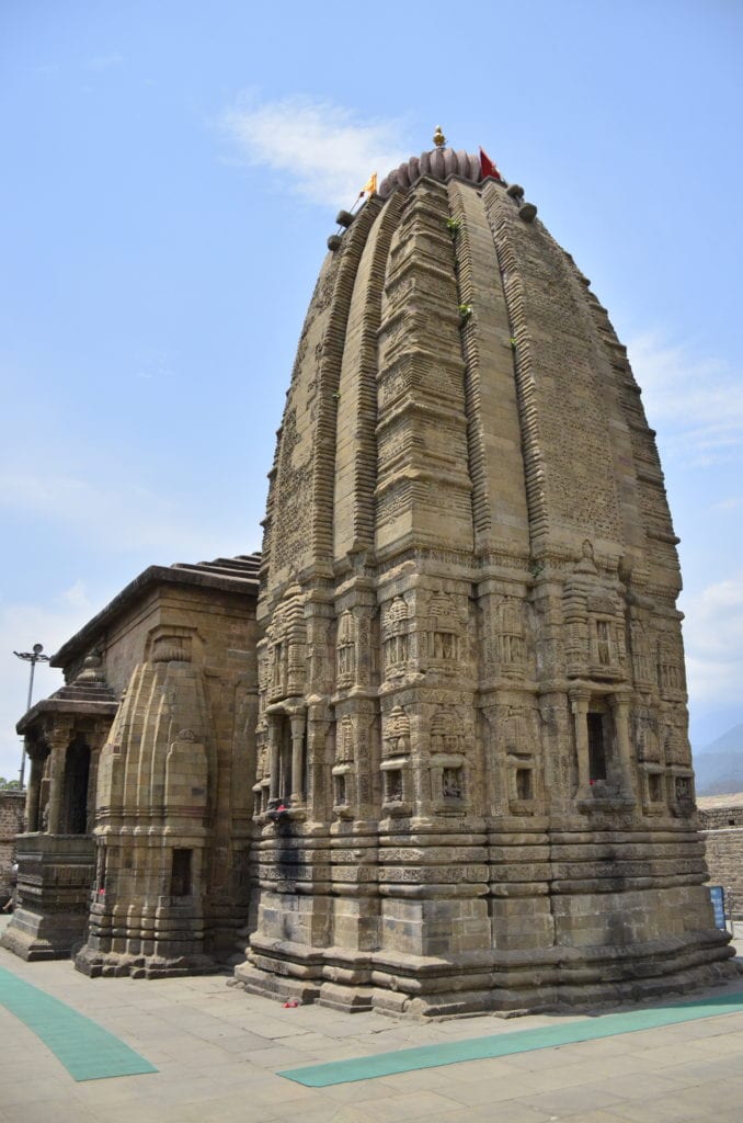

The temple is about fifty feet tall, very grand for this region. The architecture is impressive, with several elements of temple design integrated. Unlike most other temples of Himachal, it also has two balconies at the ground level.
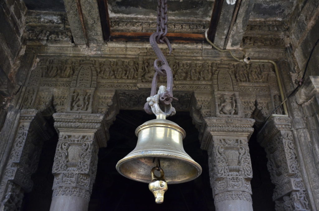
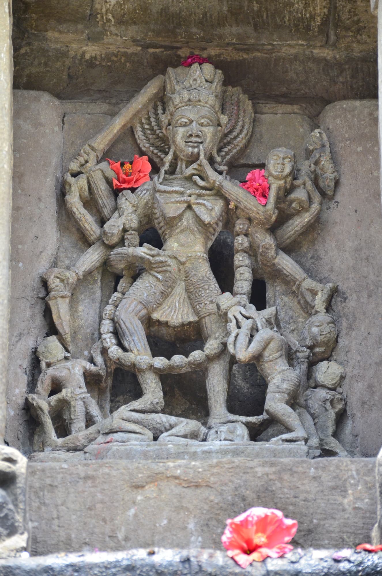
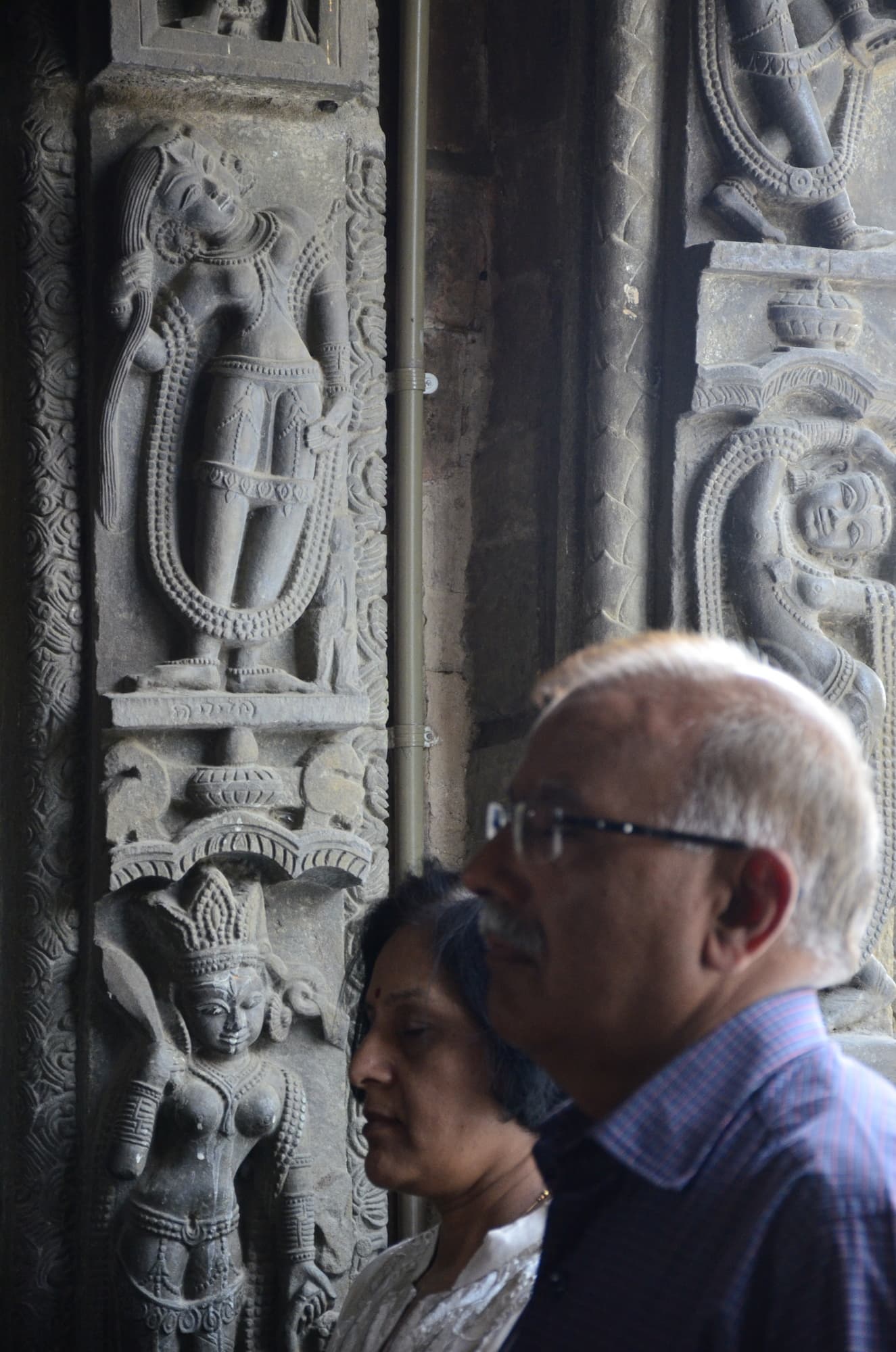
The sculptures are a delight. They are richly carved; and the style and proportions of the sculptures are very uncommon. A standing Nandi and a slightly kneeling Ganpati are wonderful. A dash of hibiscus on the Ganpati; that sight alone captures the joy of idol worship.

Idols, worshipped, adorned
It overlooks the entire Dauladhar range that rises from 500 odd meters to almost 5000 meters in a single vertical span. In between is the shallow valley with a gently flowing Binduka. There are only a few temples that can match the setting, like Kedarnath, Mahabalipuram, Tiruchendur, Somnath..
It is maintained by ASI, so there is a nice clear grassy perimeter; and photographs are allowed. The temple excels in cleanliness even for Himachal standards. The calm of the temple is incredible even though it is on the highway.
For a complete temple experience, Baijnath is one of the places to head to.
I first went to Baijnath in Himachal with my in 2013. I have been there twice since then, once for gratitude and the second time with son; and there will be more times.
The region around has so much to offer; the grand paragliding experience at Bir, the tea estates (overrated) of Palampur, the calm of Kanbari ashram, and the temple stretches of Chamunda and Kangra. It is an endless list.
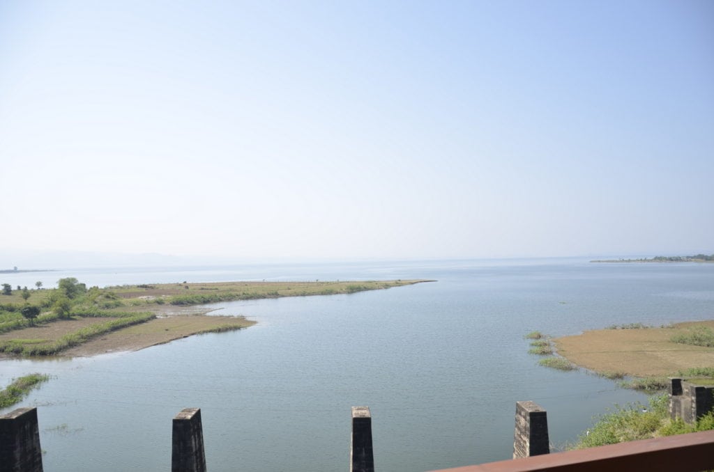
Along the poong dam 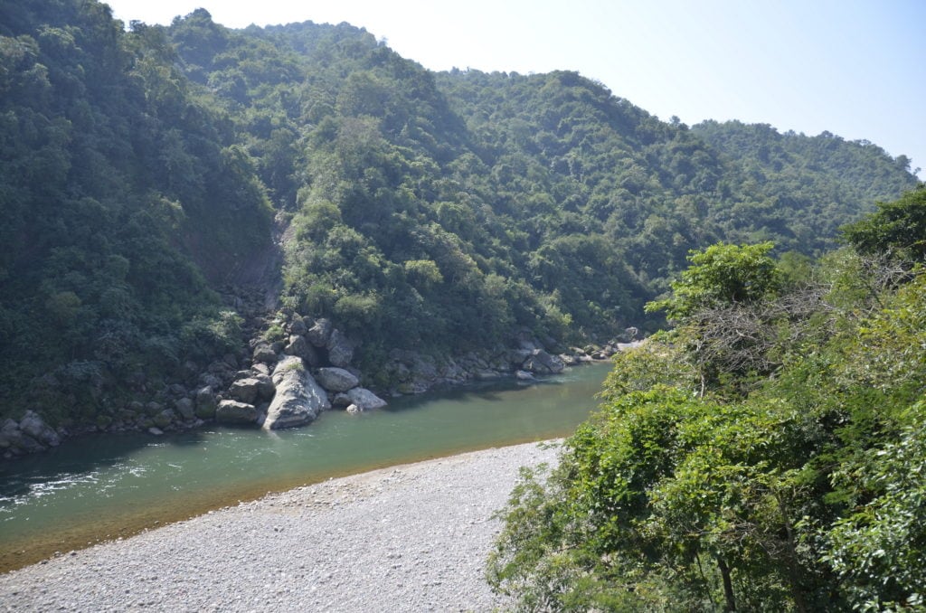
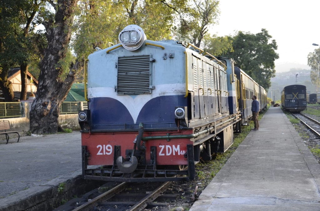
The Toy Train itself 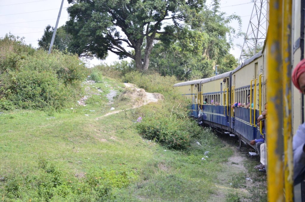
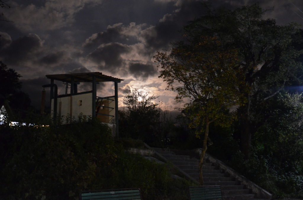
Joginder Naar with moonlight
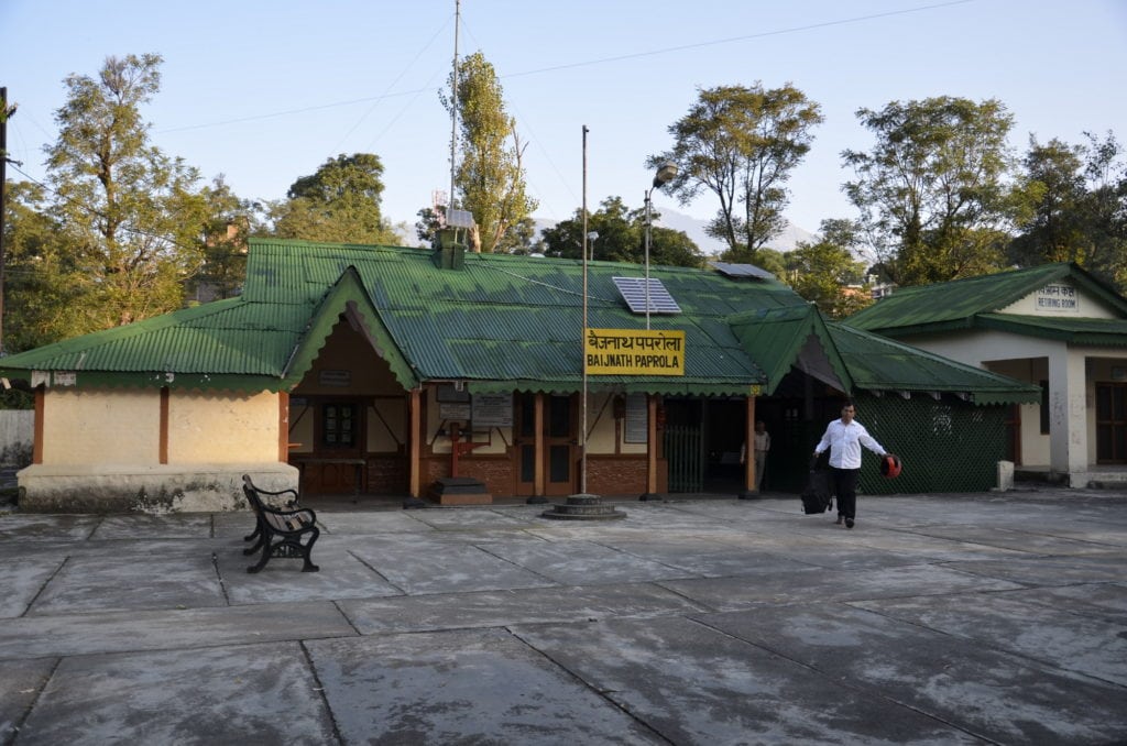
Then the incredible views of Dhauladhar hills from Andretta. Then there is the Barot valley and its funicular which I hope to see one day. The piece de resistance is the toy train that runs from Joginder Nagar to Pathankot. The train travels through unparalleled (and totally underrated) variety of landscapes overlooking lakes, rivers, gorges, snowclad mountains. It is actually a train that transports, without the touristy character of other hill trains.
If you have a chance to spend two or more days out of Delhi, head to Baijnath region. Gaggal airport of Dharamshala is 50 kms from Baijnath.
A short beautiful drive through tea gardens; and then you are at the perfect setting for your soul.
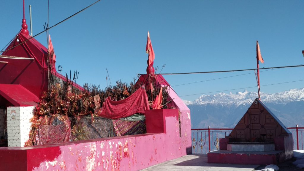
Everyday life at Kali Bhari, Shimla
Kali Bhari at Shimla. Temples of Himachal …10.
There are grand temples, there are popular temples and there are temples at great locations. Then there are some that are part of everyday life.
Kali Bari temple in Shimla is a part of the daily life. It is an interesting blend of native history and migration. Kali as Shyamala represents what is native, giving the city its name; and as Kali, gives identity to the Bengalis who accompanied the British into the city in its early years.
It is at the western end of the ridge, a few hundred meters after Scandal point where most tourists stop. My client in Shimla has a habit of walking to the temple every day, and I have accompanied him a few times.
The temple is grand because of this routine of its devotees. One June, we were at the temple when it had started raining heavily, The chill was unbearable and bare feet were making it worse. I took a glance from within the temple outside.
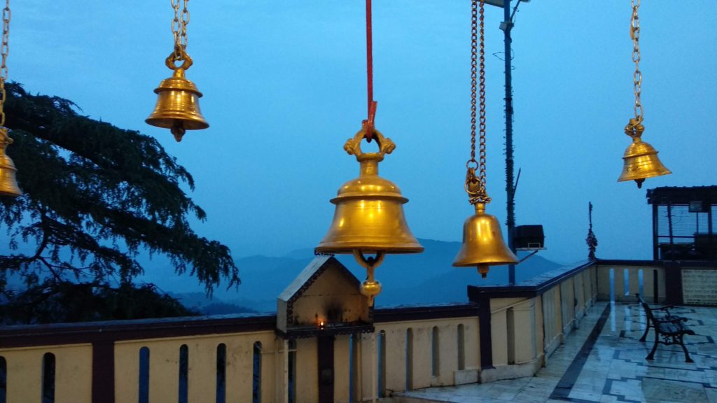
There is a small but open courtyard and you can look at all of Shimla from there. A bench if you are tired of the walking, a tiny oil lamp on the wall, shielded from the rain and snow; which must have been here since 1845. Then the sight of modernity – a solar lamp post. The sight of the bells in the background of dusk, create serenity. The locality is nothing such, but faith does create an oasis.
Everyday life at Kali Bari temple, Shimla
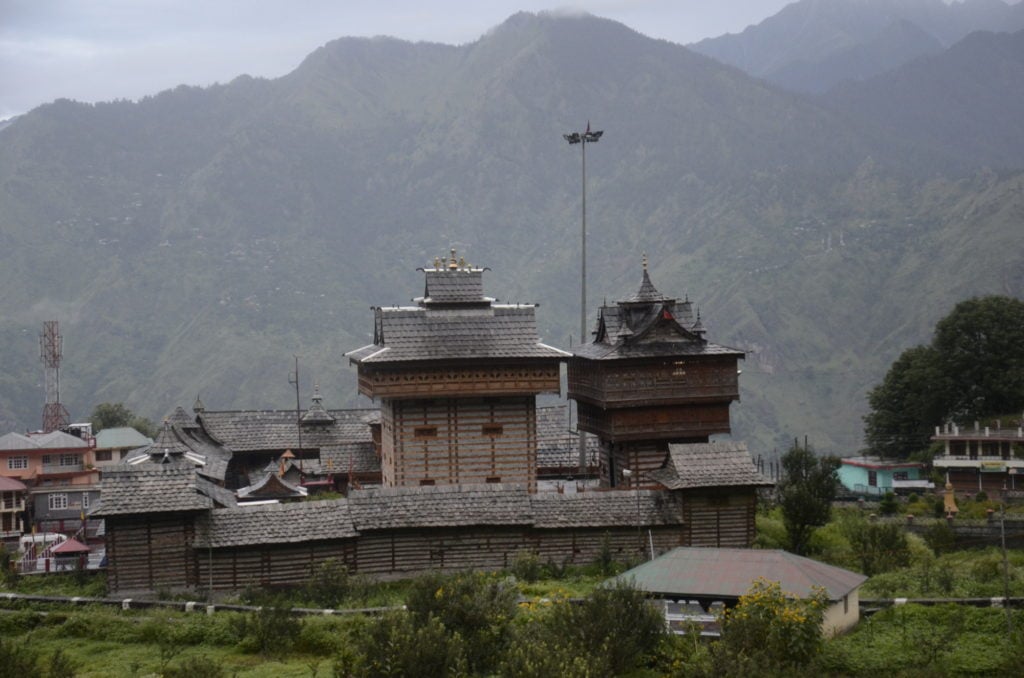
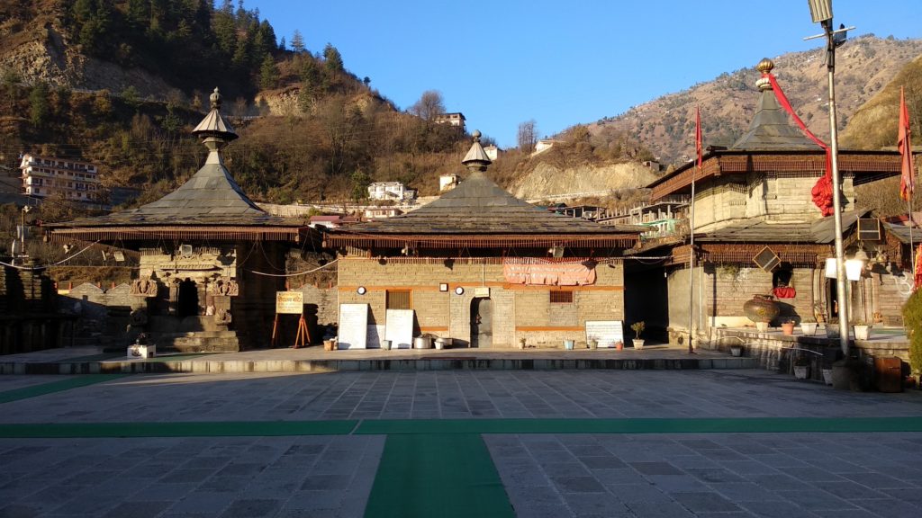
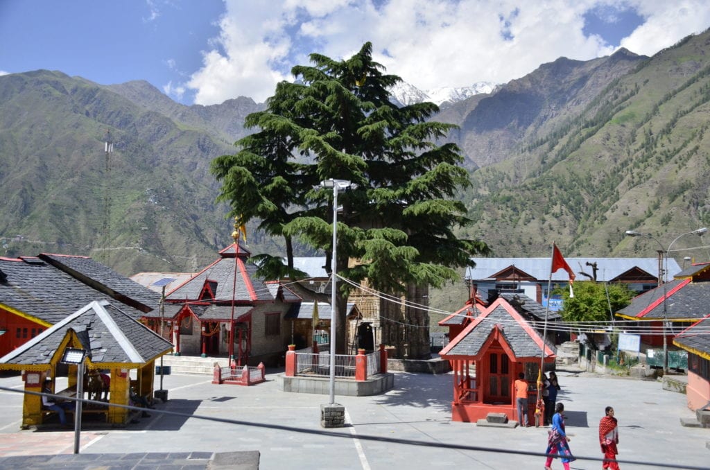
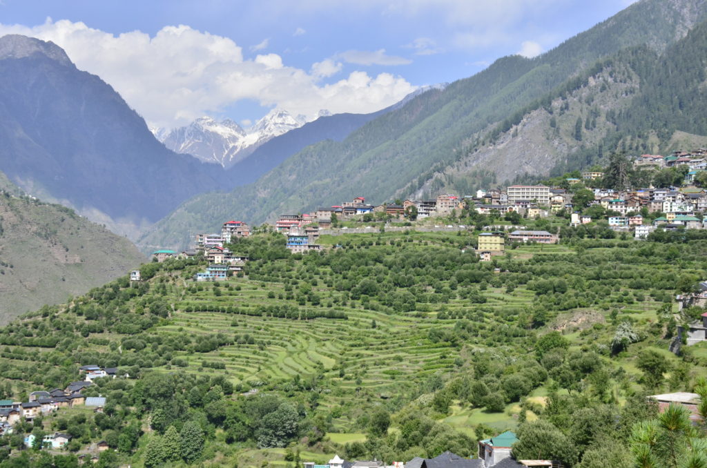
Land’s end at Bharmour
Chaurasi temple of Bharmour. Temples of Himachal ….9.
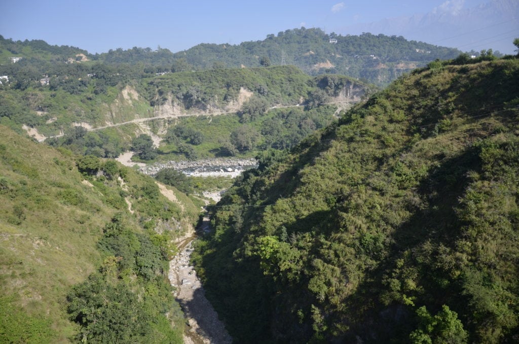
Bharmour is as far as you will go. It is surrounded by 16000 feet high mountains on three sides, the hill equivalent of a peninsula. It is at the dead end of a sliver of a valley. Squeezed between the Dauladhar range and the Pir Panjal range, you can enter the valley by road, but can’t exit anywhere further and have to retrace.
Bharmour contributes to the Ravi river, though it is not the source. Ravi is one of the most secretive rivers of India, hardly flowing through any large city before it snakes along and forms a length of the Indo-Pak border.
The temple square at Bharmour
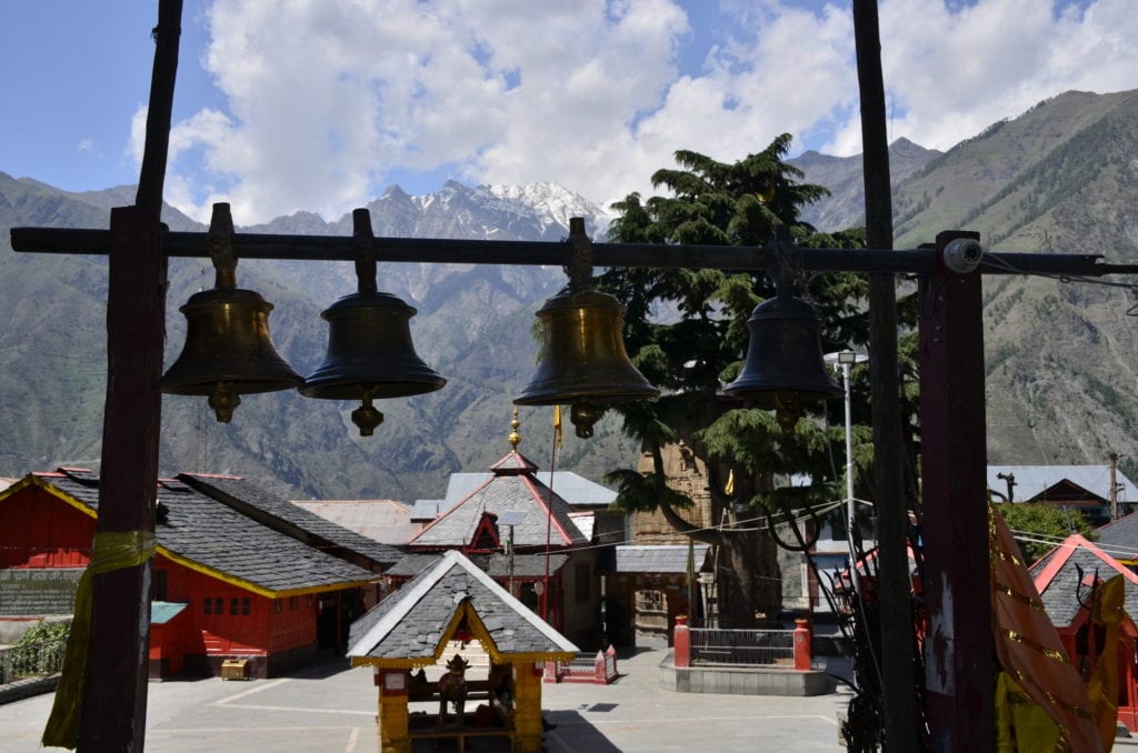
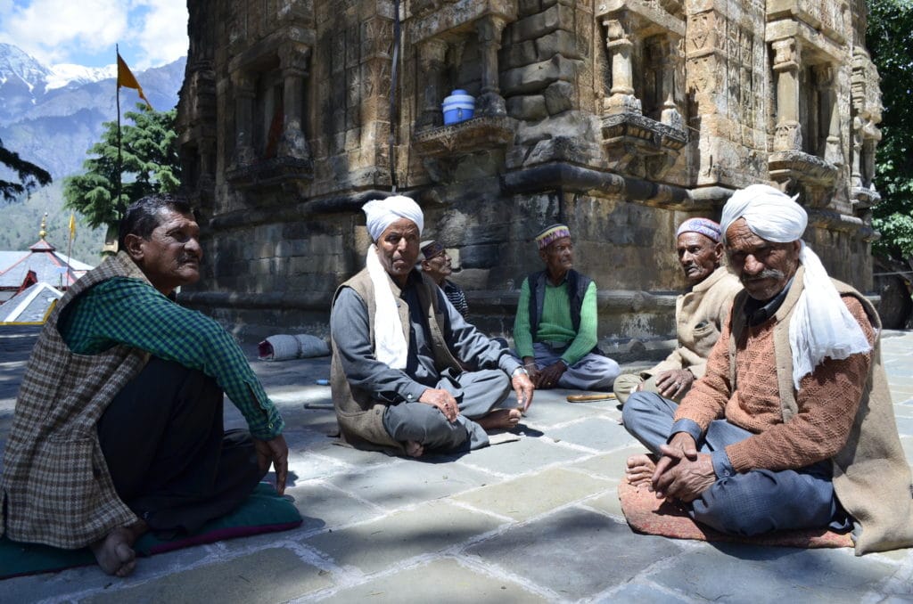
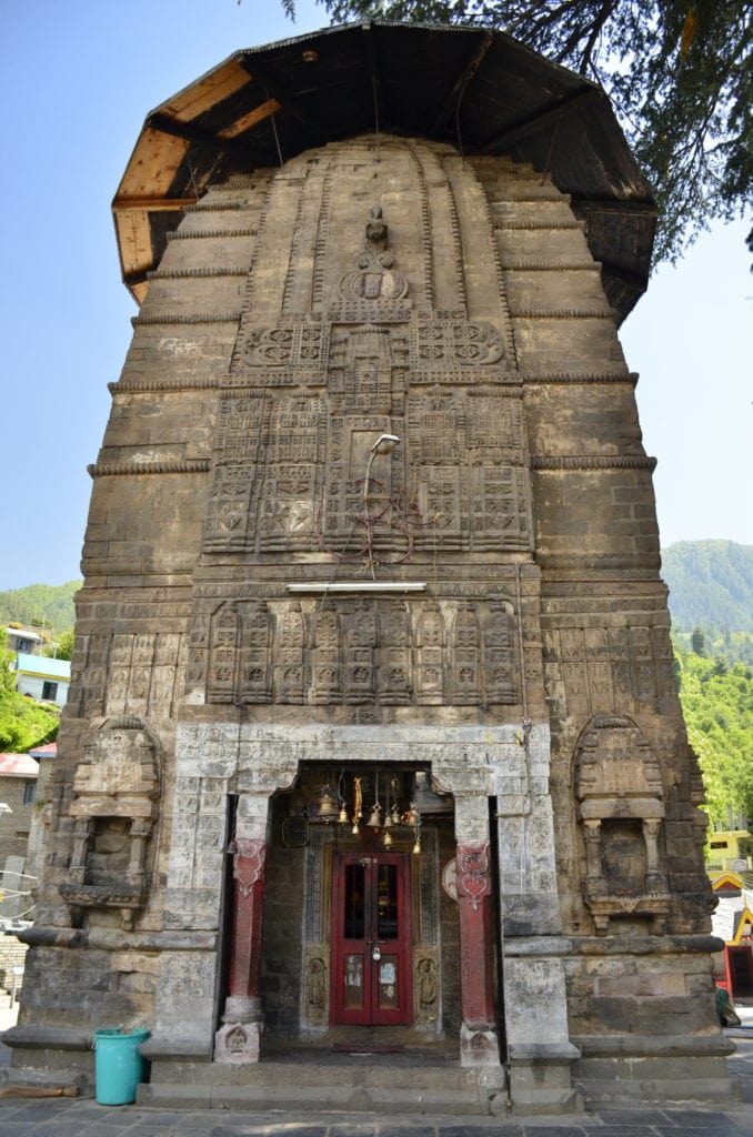
The Chaurasi temple at Bharmour is an experience. It is, as far as I can recollect, one of the largest temple complexes of Himachal. It is at a remarkable setting, overlooking hills on all sides. It is open and is not a walled temple and a collection of temples, 84, though many of them are tiny and share a common space.
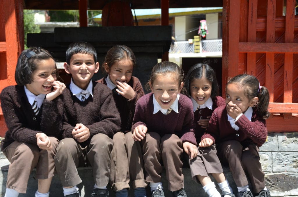
The central temple is breathtaking. Alongside the temple stands a Deodhar tree, almost double its height. The most delightful part of the complex is the schools in the square. There are several and you can hear the sweet cacophony all around; and then suddenly it was lunch break. Kids poured out of the various schools, jumping into the temple. A cricket match, and a bunch of girls just giggling away. Far away from almost anywhere, there is unspoilt innocence.
Joy of a lunchbreak
Then the farm produce, the Bharmour Rajma, the walnuts, and chukh, the famous red chilly pickle.
Bharmour and the rest of the Chamba district will overawe you, totally bereft of the commercialisation you will see in Manali and Shimla. It is an effort to reach there, but next time you plan Amritsar, take the effort to go up to Chamba, and then Bharmour.
Land’s end. Chaurasi temple, Bharmour, deep inside Chamba district, deep inside Himachal Pradesh.
Bharmour Adda
The green basket distracts, but also keeps the place clean
Schools overlook this open temple square
Bharmour itself